Geo Vermonter
https://geoguessr.com/ is a game built using Google Maps
In this project we will build our own version of the game using locations inside Vermont.
First, clone the starter project here:
http://github.com/BurlingtonCodeAcademy/geo-vermonter
cd into the repo directory and then run npm install
Tech:
- web layout and UI
- embedding maps APIs
- geocoding APIs
- DOM event handlers
Game Rules:
- when the player starts a game, they are dropped into a random spot inside Vermont
- initial score is 100
- the zoom level is pretty high (low to the ground) and there are no streets or markers, only satellite imagery
- the map does not support zoom out, or slippy click-and-drag-to-move -- all movements must be deliberate, by clicking one of the north / south / east / west buttons
- every time the user clicks a movement button, the map moves a fixed amount in that direction, and the score is decreased by 1
- when the player clicks "Guess!" they can choose a county from a popup menu
- if the guess is correct then:
- the game displays "You win!"
- their final score is logged [how?]
- the Info box is filled in with the correct latitude and longitude
How do we get the nested list of Vermont towns and counties?
State Transition Diagram
TODO
User Stories
Basic Layout
- Sketch out wireframes for a page with the following page elements.
| Selector | Description |
|---|---|
map |
shows the current map (initally the entire state of Vermont) |
nav |
top of page, placeholder for "about" and "high scores" and such |
info |
contains fields for... |
latitude, long, county, town |
read-only text fields |
north, south, east, west |
buttons for movement |
start, guess, quit |
buttons labeled "Start a Game", "Guess the Spot", "I Give Up!" respectively - all disabled for now |
score |
text field |
- Then code the layout in HTML with placeholder information
- Run the cypress tests:
- use
npm testto run them immediately on the console - find screenshots undercypress/screenshots/geo_vermonter_tests - use
npx cypress opento run them interactively in the browser GUI
- use
State of the State
Using leaflet.js place a map of the state of Vermont inside the map div. Use the Isri.WorldImagery tileset and make sure not to show any street or town info to the user -- only satellite images.
The map should be at a fixed zoom level, enough to show just the boundaries of the state and not much more.
The boundaries of Vermont are specified in border.js. Ask Josh for further instructions.
Game On
When the user clicks Start a Game
Then the Start button is disabled
And the Guess button is enabled
And the Quit button is enabled
Random Spot
When the user clicks Start a Game
Then the app chooses a random lat/long position inside the boundaries of Vermont
- leaflet-pip is a library for finding out whether a point is inside a polygon
And zooms and centers the map to that location, with a different fixed zoom level of 18
And displays question marks inside the lat, long, county, and town fields
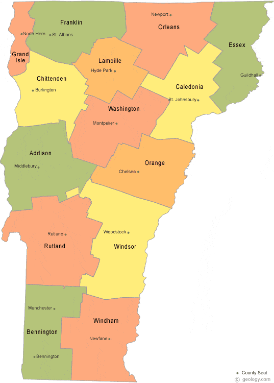
(optional) And displays a small map of Vermont counties on the side, e.g. https://geology.com/county-map/vermont-county-map.gif
I Give Up!
When the user clicks the "I Give Up" button
Then the app displays the lat/long position inside the info panel
And uses geocoding to look up the town and county, and displays those inside the info panel
Guess the County
When the user clicks the Guess button
Then the user sees a modal dialog box (or a modeless dialog box) asking "What county are we in?" with a popup list of all Vermont counties
And two buttons ("Guess" and "Cancel")
When the user selects the correct county and clicks "Guess"
Then the game fills in that county name in the Info box (instead of a question mark) (as well as the other geocoded information)
And informs the user "Correct!"
When the user types in an incorrect county
Then The game subtracts 10 from score
And informs the user "Wrong!"
And the dialog box disappears
When the user clicks "Cancel"
Then the dialog box disappears with no change to score
Move
When the user clicks the "North" button
Then the map scrolls a fixed distance to the north
And the score is reduced by 1 point
(and same as above for East, South, West buttons)
Return
When the user clicks the "Return" button
Then the game scrolls back to the original spot, with no change in score
breadcrumbs
When the user clicks a movement button
Then the map draws a dotted line between the previous map center and the new map center
And keeps showing the dotted line during the rest of game
save score (local)
When the user wins a game
Then the game asks the user for their name (or remembers from earlier)
And saves the name and score to a list of games
When the user selects "high scores" from the nav bar
Then the app shows a list of all games, in score order (top to bottom)
For the first pass, use LocalStorage so it persists across game sessions. BEWARE that the values can only be strings, so you must use
JSON.stringifyon the way in andJSON.parseon the way out.
save score (server)
When the user wins a game
Then the game saves the name and score to the server
When the user selects "high scores" from the nav bar
Then the app shows a list of all games, in score order (top to bottom), including scores from all other players
Tech:
Initially, implement your server code as simply as possible. Over the course of the week, we will learn more ways of saving state on a server or database.
- in RAM (a list of JS objects in an array) -- this will get erased when you restart the server but will be just fine for demos
- in a file -- this will work locally but will not work on Heroku
- in MongoDB
Replay game:
- when the game is saved, don't just save the name and score: all the info, including spot and all moves taken, and any guesses, should be saved as well
- when viewing old games, the user can select one and see the above info
- a live replay at one move per second (this will likely be a whole new story)
Backlog
Ideas for future work:
Invent some new game modes, and put links to the various modes inside the nav bar. For instance...
- Guess the town, not the county
- Daily Challenge - every user uses the same point
- Burlington Challenge - guess the neigborhood